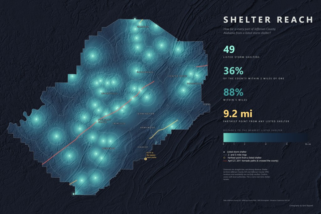
How far is every part of Jefferson County, Alabama from a listed storm shelter? This map answers that question for the whole county. Areas close to one of the 49 listed shelters glow teal, and the color fades to deep blue as the distance grows. About 36 percent of the county lies within 2 miles of a listed shelter and 88 percent within 5 miles. The farthest point is 9.2 miles from the nearest one.
I rebuilt this map in ArcGIS Pro with an arcpy script. The distance surface was calculated with Spatial Analyst’s Euclidean Distance tool from the shelter locations, and the coverage percentages and farthest point were computed directly from that surface. Dashed rings mark the 2- and 5-mile distances, and soft shaded relief from Copernicus 30 m elevation data shows the ridges and valleys the county is built around. The six April 27, 2011 tornado paths that crossed the county, from National Weather Service Birmingham data, are drawn by Enhanced Fujita rating as a reminder of why shelter access matters here.
The pattern is easy to see: listed shelters cluster along the valley from Pleasant Grove through Birmingham to Center Point, while parts of the southern and eastern county are much farther from one.
Distances are straight-line, not driving distance. The shelter list comes from Jefferson County GIS and Jefferson County EMA; locations and availability are not fully verified. Confirm access with local authorities. This is not a real-time shelter locator.

