Purpose
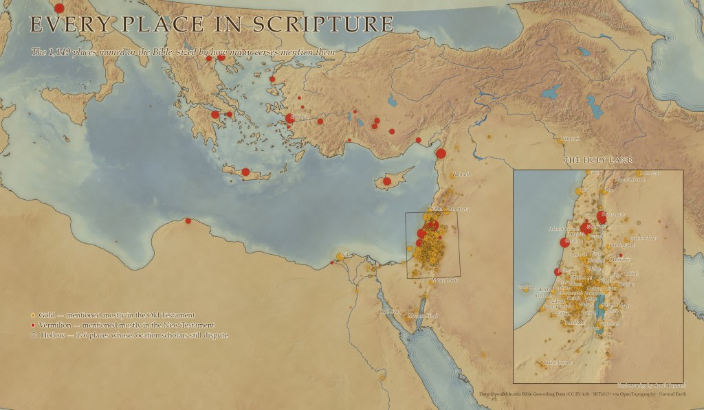
Every place the Bible names, on one map. I wanted to show how the biblical story spreads across the ancient world, from Ur and Babylon to Rome, while most of it unfolds in a strip of land smaller than New Jersey. Each place is sized by how many verses mention it. Gold marks places named mostly in the Old Testament, vermilion mostly in the New, and hollow rings mark the 176 sites whose locations scholars still debate.
Data
OpenBible.info Bible Geocoding Data (CC BY 4.0); SRTM15+ elevation and bathymetry via OpenTopography; Natural Earth coastlines, rivers, and lakes.
Tools
ArcGIS Pro, Spatial Analyst, and Python (arcpy).
Process
I wrote an arcpy script that downloads and parses the 1,149 geocoded places, counting each place’s mentions by testament and scoring how much scholars agree on its location. The base is styled like a hand-colored antique atlas: a procedurally generated parchment texture, a watercolor wash keyed to elevation and seafloor depth, a soft relief blended from several light directions, and engraved-style ripple lines along every coast. Because most places crowd into the Holy Land, I added an inset that zooms into Israel and Jordan with its own labels.

