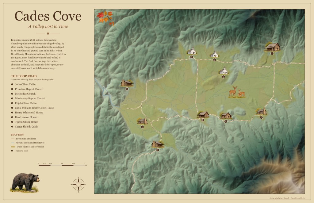
Cades Cove is a broad valley ringed by mountains in Great Smoky Mountains National Park. John and Lucretia Oliver settled here in 1818, and by 1850 the cove was home to 685 people. Today the cabins, churches and mill that remain line the 11-mile one-way Loop Road, and this map follows that drive.
I rebuilt this map in ArcGIS Pro with an arcpy script. The open fields of the cove floor were found from elevation and slope and drawn as a soft patchwork of hay-gold fields, so the valley stands out from the forested ridges around it. Abrams Creek and its tributaries were traced from the elevation model with hydrology tools, and the Loop Road and lanes are drawn as a warm dashed ribbon. My watercolor-style illustrations of the cabins and churches now sit on their exact locations, numbered 1 to 10 in driving order, with the names listed in the side panel alongside a short history of the cove.
The title, A Valley Lost in Time, comes from what happened when the national park was created: the families left, but their buildings and fields were kept. The map is meant to show the cove the way a visitor experiences it, one stop at a time around the loop.

