Purpose
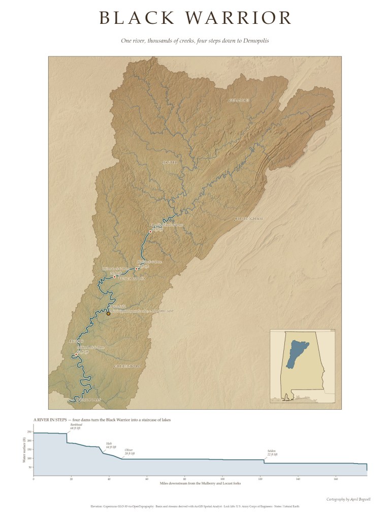
My first Black Warrior map showed one stretch of the river. This one shows all of it: every creek in the basin, from the hills around Cullman, Jasper, and Birmingham, funneling into the Mulberry, Locust, and Sipsey forks and then into one river that winds 178 miles to the Tombigbee at Demopolis. The profile along the bottom tells the river’s other story. Four locks and dams (Bankhead, Holt, Oliver, and Selden) turn what was once a river of shoals into a staircase of lakes.
Data
Copernicus GLO-30 elevation via OpenTopography; basin and stream network derived in ArcGIS Spatial Analyst; lock lifts from the U.S. Army Corps of Engineers; state outlines from Natural Earth.
Tools
ArcGIS Pro, Spatial Analyst, and Python (arcpy, NumPy, Matplotlib).
Process
Instead of a basemap, I built the whole map from elevation data in an arcpy script. I filled the DEM, calculated flow direction and flow accumulation, and outlined the basin with a pour point at the Tombigbee confluence. Every stream draining at least 8 km² is drawn, with line width growing by Strahler stream order. To find the main stem, the script walks upstream from Demopolis cell by cell, always following the most accumulated flow, until it reaches the Mulberry and Locust forks. The traced river came out at 177 miles, within a mile of the official length. I sampled elevation along that path for the profile chart, and styled the base with parchment, a soft multi-directional hillshade, and a watercolor tint that keeps the floodplain green and the uplands warm, with land outside the basin faded back.

