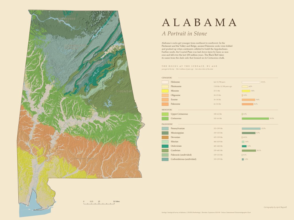
Alabama’s rocks get younger as you travel from the northeast to the Gulf. This map colors the rocks at the surface by age, from Cambrian rocks more than 485 million years old in the Valley and Ridge to river and coastal deposits laid down in the last 11,700 years.
I rebuilt this map in ArcGIS Pro with an arcpy script, using the Geological Survey of Alabama’s 1:250,000 surface geology. Each unit uses the standard colors of the International Chronostratigraphic Chart, softened slightly for the parchment page. The legend is arranged the way geologists read time, youngest at the top and grouped by era, and each unit has a bar showing how much of the state it covers, calculated from the data. Cretaceous rocks cover the most, about 19 percent, followed by the Pennsylvanian rocks of the Cumberland Plateau’s coal country. Soft shaded relief from Copernicus elevation data brings out the folded ridges of the northeast and the branching stream valleys of the Coastal Plain.
In the Piedmont and the Valley and Ridge, ancient Paleozoic rocks were folded and pushed up as the Appalachians formed. Farther south, the Coastal Plain was built layer by layer as seas rose and fell over the last 100 million years, and the Black Belt takes its name from the dark soils that formed on its Cretaceous chalk.

