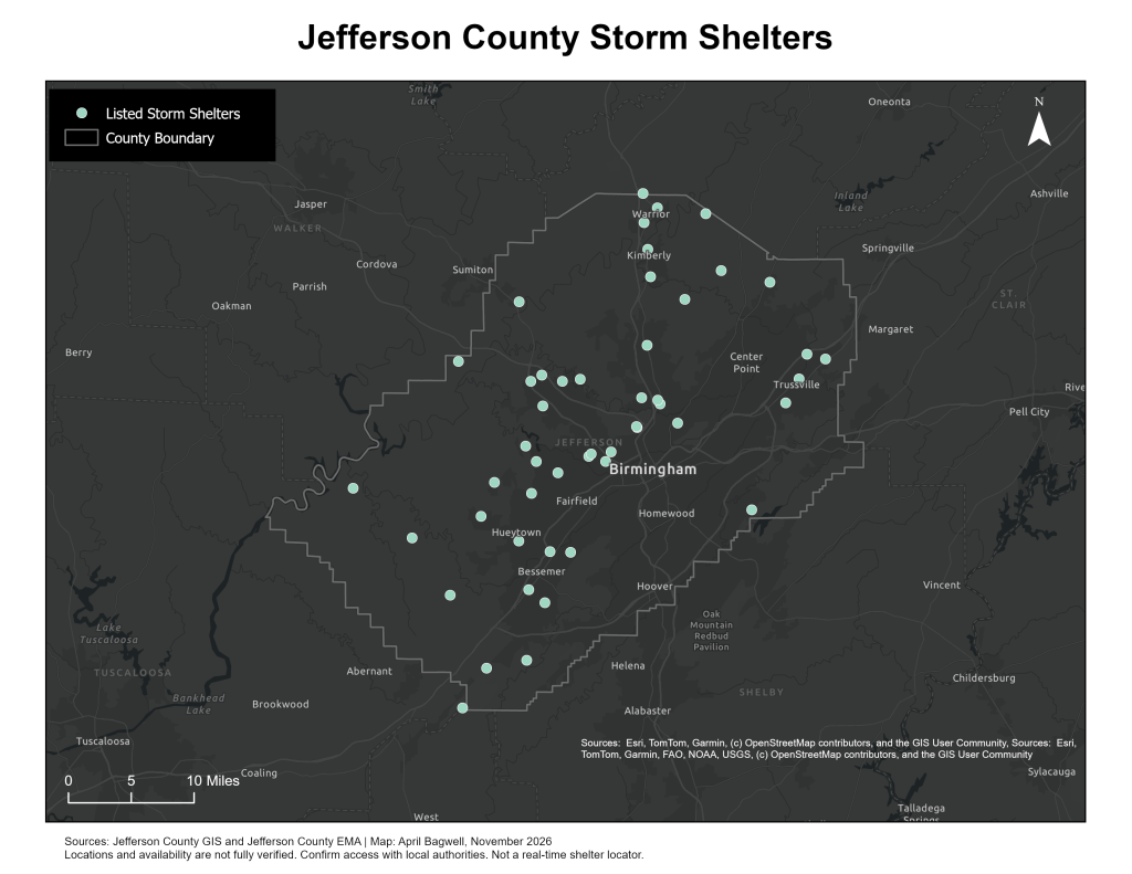
A GIS map of storm shelter locations throughout Jefferson County, Alabama, designed to illustrate the geographic distribution of emergency shelter resources. Created in ArcGIS Pro using publicly available emergency management and geographic data, this project highlights the role of GIS in severe weather preparedness, public safety, and community resilience.